
Compass Toolkit
Find your way, offline.
Compass Toolkit puts a whole outdoor navigation kit in one beautifully crafted app. At its heart is a stunning brass-amber marine compass — a real, gorgeously rendered instrument that shows heading, cardinal points and true vs magnetic north, so orienting yourself feels like holding a fine piece of gear rather than reading a flat dial. Around it sits everything an explorer needs: precise GPS coordinates in DMS, decimal or UTM you can copy and share; live altitude and barometric pressure; a digital bubble level for setting up a tripod, hanging a shelf at camp or checking a slope; sun and moon rise and set times with golden-hour and blue-hour windows for photographers; and waypoints you can drop, name and see together on a map. When you find somewhere worth remembering, a share-location card turns your spot into a clean, sendable snapshot. Compass Toolkit works offline — the compass, coordinates, altitude, level and sun & moon calculations all run entirely on your device with no signal needed; only the waypoint map loads Apple map tiles when you happen to have a connection. It is 100% on-device with no account and no tracking: your data stays on your device and is never uploaded to us or anyone else. Native and universal, it's designed to feel just as at home on iPad as on iPhone. Start free with the compass and coordinates, then a single $4.99 purchase unlocks altitude, the bubble level, sun & moon times, waypoints and the share-location card — one time, no subscription, ever.
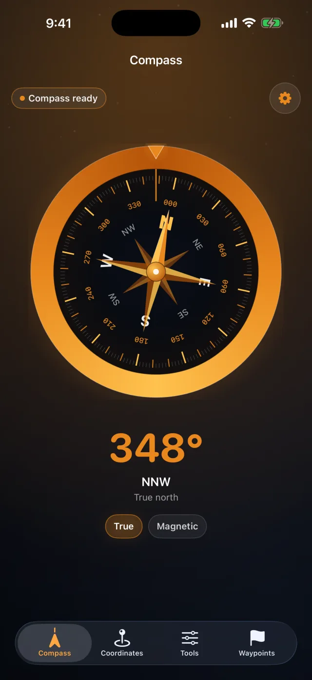
Screenshots
Real captures from iPhone and iPad. Swipe each row to see every screen; tap any to enlarge.
What it does
Marine brass compass
A stunning, gorgeously rendered brass-amber compass shows heading, cardinal points and true vs magnetic north — it feels like real gear.
Precise GPS coordinates
Read your exact position in DMS, decimal or UTM — copy and share the format you need in a tap.
Altitude & barometer
See your live altitude and barometric pressure — handy on the trail, at the summit or watching the weather turn.
Digital bubble level
A precise bubble level for setting up a tripod, hanging something at camp or checking a slope.
Sun, moon & golden hour
Sun and moon rise and set times with golden-hour and blue-hour windows — plan the perfect shot or an early start.
Waypoints on a map
Drop, name and revisit waypoints and see them together on a map (map tiles load when you have a connection).
Share-location card
Turn a spot worth remembering into a clean, sendable card — share where you are in a beautiful snapshot.
Works offline, no subscription
Compass, coordinates, altitude, level and sun & moon all run on your device with no signal — a single $4.99 unlock, no subscription, ever.